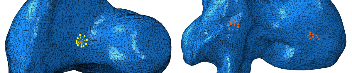
Multi-scale imaging with LiDAR
The modern technologies of GPS, satellite remote sensing, digital photogrammetry, videogrammetry and LiDAR high definition surveying are providing revolutionary approaches to geological outcrop, palaeontological and geoconservation research.
The Palaeontology group works with the Basin Studies group to access a Riegl LMS-Z420i LiDAR, Trimble ProXR GPS system and a Z+F 5010C Imager that is ideal for both geological and palaeontological applications. The GPS provides an efficient and accurate tool for the measurement of points and linear features at accessible outcrops. The LiDAR system however, allows rapid, high resolution, digital mapping of otherwise inaccessible outcrops at ranges from just a few metres to a kilometre. Scans from many different LiDAR survey stations can be merged to form seamless geo-referenced photo realistic outcrop models. The LiDAR data provides detailed spatial and geometrical information that can be used to measure and map even small-scale sedimentary architectures, fault systems and other subtle features over large areas. The data can be classified according to facies and used for palaeoenvironmental modelling and geoconservation appraisals.
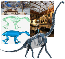
Integrated laser scanning and photogrammetry - remote methods of collecting three dimensional (3D) spatial and geometrical data - has to-date been under-utilized in palaeontology. Laser scanning provides a dense point cloud that represents a precisely sampled replica of an object’s surface geometry. Integrating a digital camera into the scanning unit allows photographic images to be combined with these point clouds to produce interactive photo-realistic 3D models. The Differential Global Positioning System (DGPS) also built into the unit provides sub-metre global position information and allows data to be integrated with other georeferenced datasets. As a non-invasive method of attaining geometrically precise 3D digital models, these techniques enable palaeontologists to explore fossils and fossil sites on the desktop where an exceptional level of visualization can be combined with analytical facilities unique to the digital environment. 3D geological mapping using integrated laser scanning and photogrammetry has provided the necessary framework for interpretation of fossiliferous localities in the context of their 3D sedimentary facies, improving understanding of the stratigraphic and palaeoenvironmental context of fossil sites. High-resolution photo-realistic models also offer remote interactive access through virtual fieldtrips, and may contribute significantly to conservation and education at palaeontological heritage sites. Building on its use to model the 3D geometry of fossil dinosaur tracks, we have also recently used laser scanning to digitize skeletal mounts of theropod dinosaurs, producing scale models that have been used to examine the mass, inertial properties and locomotor mechanics of these animals.
The Z+F Imager has also been used in studies to help calculate body mass of both extant and extinct animals. This is a critical parameter used to constrain biomechanical and physiological traits of organisms. Volumetric methods are becoming more common as techniques for estimating the body masses of fossil vertebrates. However, they are often accused of excessive subjective input when estimating the thickness of missing soft tissue. The Manchester Group have demonstrated an alternative approach where a minimum convex hull is derived mathematically from the point cloud generated by laser-scanning mounted skeletons, using the Z+F Imager. This has the advantage of requiring minimal user intervention and is thus more objective and far quicker. We tested this method on 14 relatively large-bodied mammalian skeletons and demonstrated that it consistently underestimates body mass by 21 per cent with minimal scatter around the regression line. We therefore suggested that this is a robust method for estimating body mass where a mounted skeletal reconstruction is available and demonstrated its usage in predicting the body mass of one of the largest, relatively complete sauropod dinosaurs: Giraffatitan brancai (previously Brachiosaurus) as being 23200 kg.